ASHBOURNE.
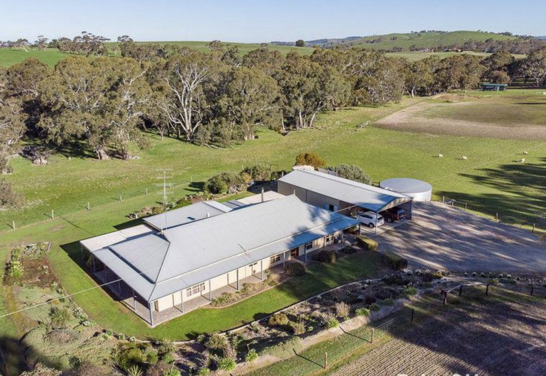
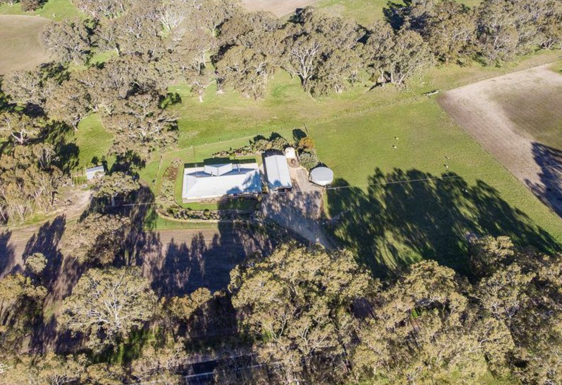
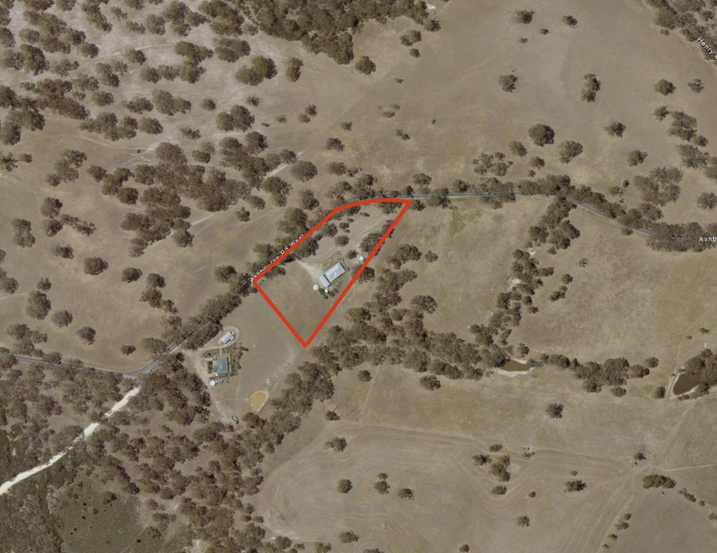
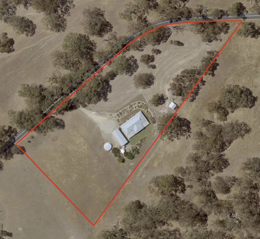
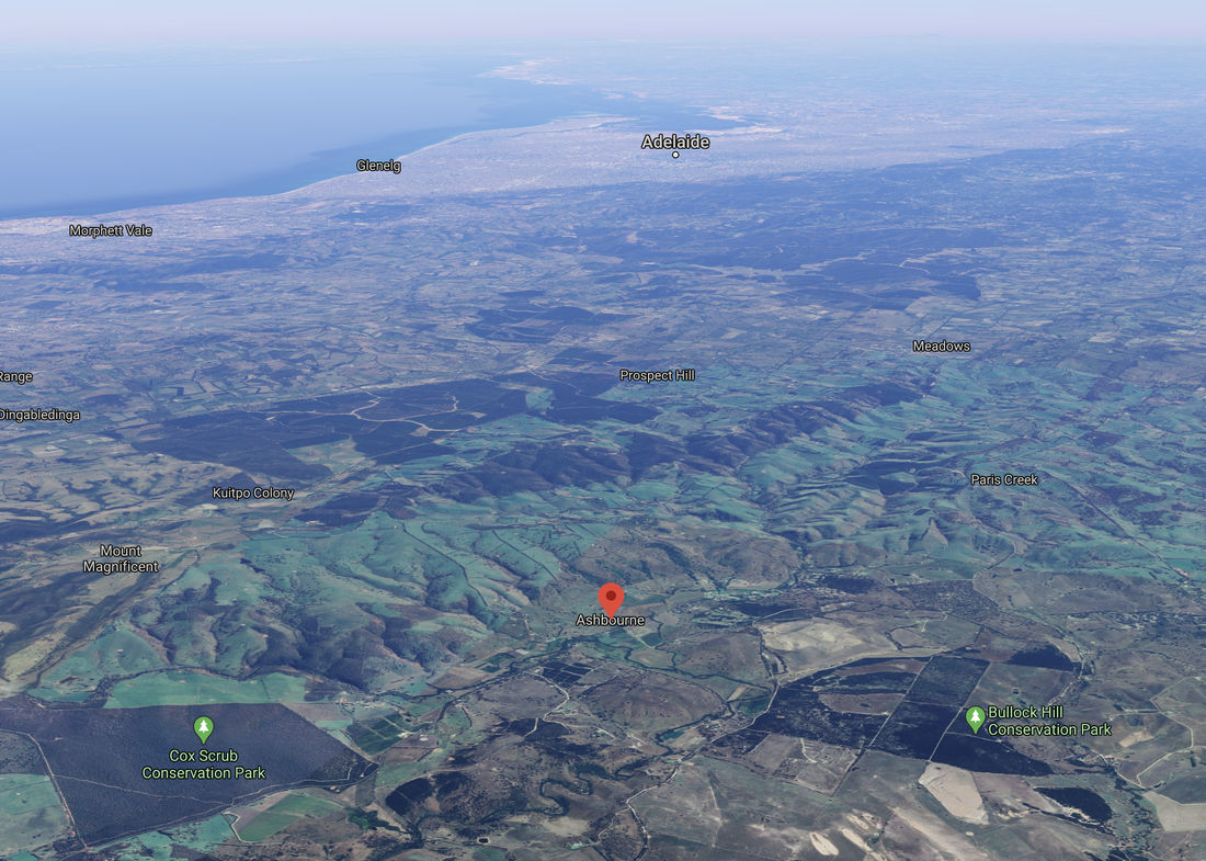
I live at Ashbourne on a 5 acre property, which is surrounded by farms and bushland.
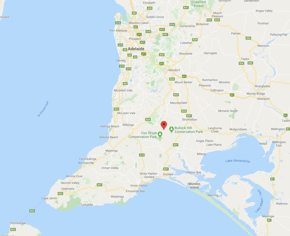
Where is Ashbourne located?
Ashbourne is a small town, located about halfway between the towns of Meadows and Goolwa, and about 14 km from the town of Strathalbyn. It is located about 63 km south of the city of Adelaide.
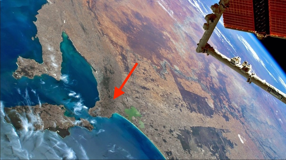
Above:- a view of South Australia from the International Space Station. The red arrow shows Ashbourne where I live. Image c/o Historic Yorke Peninsula Facebook page.
The town is nestled in a valley at the intersection of Bull Creek and Finniss River. Bull Creek takes its name from John Wrathall Bull (1804-1886), a settler, inventor and author in the early days of colonial South Australia. The Finniss River was named by Governor Gawler in 1838. The aboriginals called it kundopari meaning twisted river.
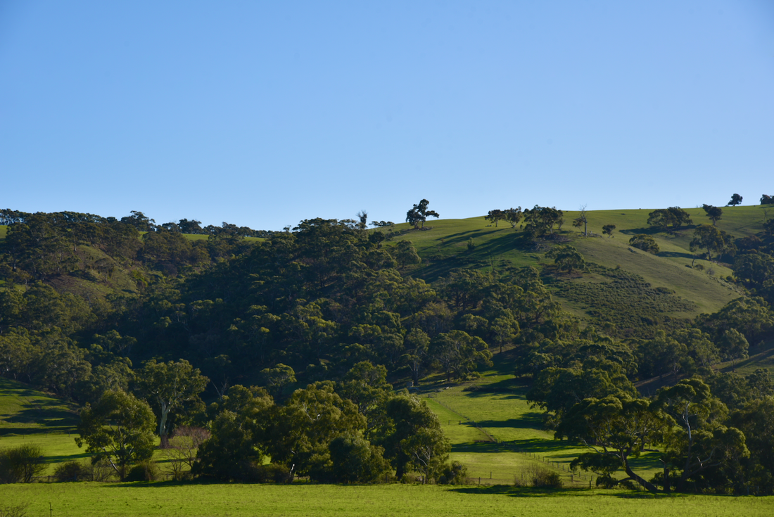
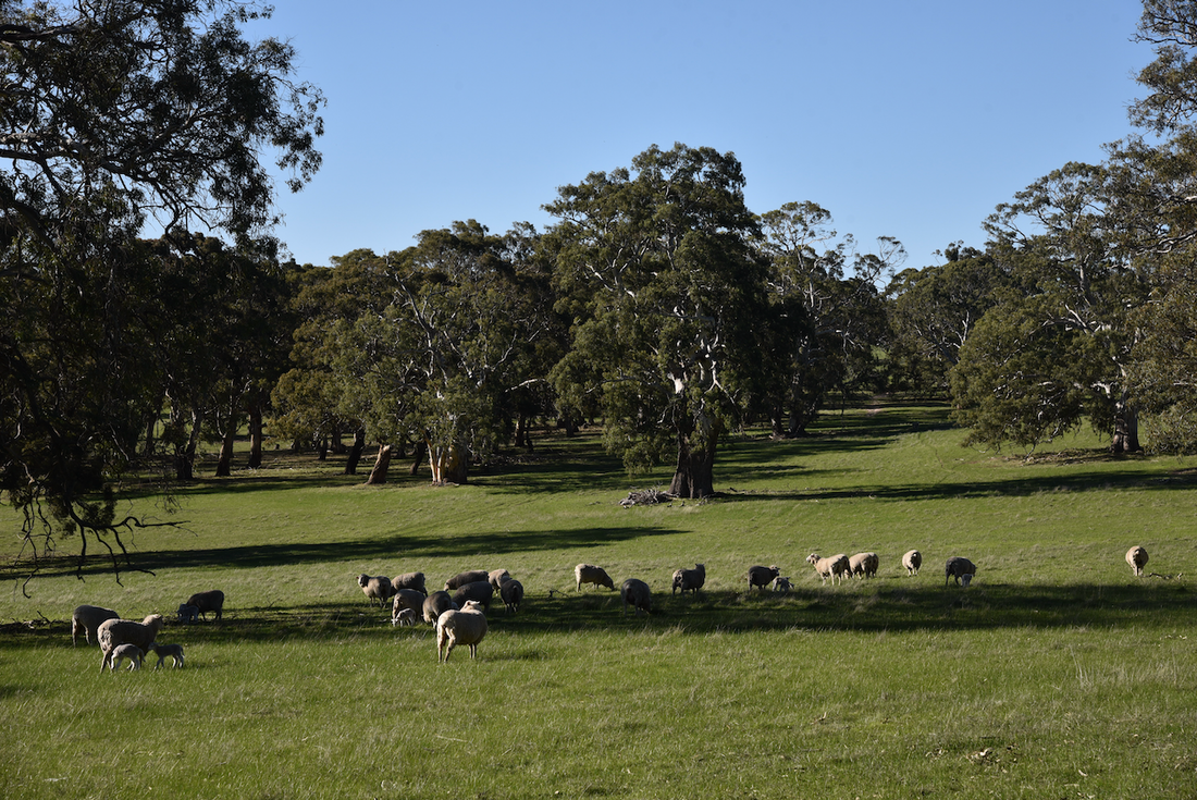
Although the district commenced as a potato growing and dairying valley, Ashbourne later became known for its apples and pear orchards but the main orchards now are commercial avocado orchards.
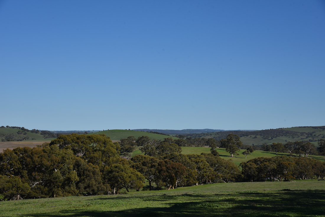
The road between Ashbourne and Strathalbyn is a winding avenue of grand old red gums and is one of the most scenic strips of road on the Fleurieu Peninsula.
The road between Ashbourne and Strathalbyn is a winding avenue of grand old red gums and is one of the most scenic strips of road on the Fleurieu Peninsula.
|

|
|
|
|
|
History of Ashbourne.
In 1834 in the United Kingdom the South Australian Colonisation Act was passed, which lead to the British colonisation of South Australia. The South Australian Company was formed in London on 9 October 1835. The founding board was headed by George Fife Angas and consisting of other wealthy British merchants. Its immediate purpose was to encourage the purchase, in advance, of land in the planned colony.
It was deemed that land should be sold in small sections, ideally about 80 acres.
The South Australian Company gained provision for Special Surveys which gave advantage to those with substantial capital to become large-scale landowners who often picked out the best parcels of land.
The intending purchasers paid £4000 and could ask for a Special Survey of 15,000 acres subdivided into 80 acre sections (16,000 from October 1839). A number of Special Surveys were conducted and a total of 37 had been completed by the end of 1840.
On the 8th day of July 1839, the twenthy-fifth Special Survey (no. 12 on the map), known as the 'Greenhills Survey' was claimed by Sir John Morphett. The name was in acknowledgement of the character of the region. The original survey which contained the sites of the settlements of Bull Creek and Ashbourne and was surveyed by J.H. Burslem in January 1841.
Morphett was was a South Australian pioneer, landowner and politician, who was.born in London on the 4th day of May 1809. On the 20th day of March 1836, Morphett sailed for South Australia aboard the Cygnet, which arrived at Kangaroo Island on the 11th day of September 1836, and then sailed for Holdfast Bay arriving there on the 5th day of November 1836.
Morphett was was a South Australian pioneer, landowner and politician, who was.born in London on the 4th day of May 1809. On the 20th day of March 1836, Morphett sailed for South Australia aboard the Cygnet, which arrived at Kangaroo Island on the 11th day of September 1836, and then sailed for Holdfast Bay arriving there on the 5th day of November 1836.
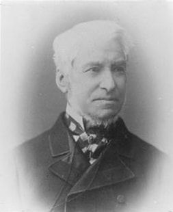
Sir John Morphett
Morphett purchased 4,000 acres for £4,000 from 15,000 acres in that district of country extending generally to the south-east of the survey called 'The Three Brothers' taken by J.B. Hack and to the east of the eastern boundary of 'The Meadows Survey'.
The highest hill beside the Finniss River was named Morphett Hill.
Morphett's application for 42 sections of 3,006 acres, was coupled with an application by Colonel Patrick Vans Agnes of Barnbarrock in Scotland, for 994 acres.
The highest hill beside the Finniss River was named Morphett Hill.
Morphett's application for 42 sections of 3,006 acres, was coupled with an application by Colonel Patrick Vans Agnes of Barnbarrock in Scotland, for 994 acres.
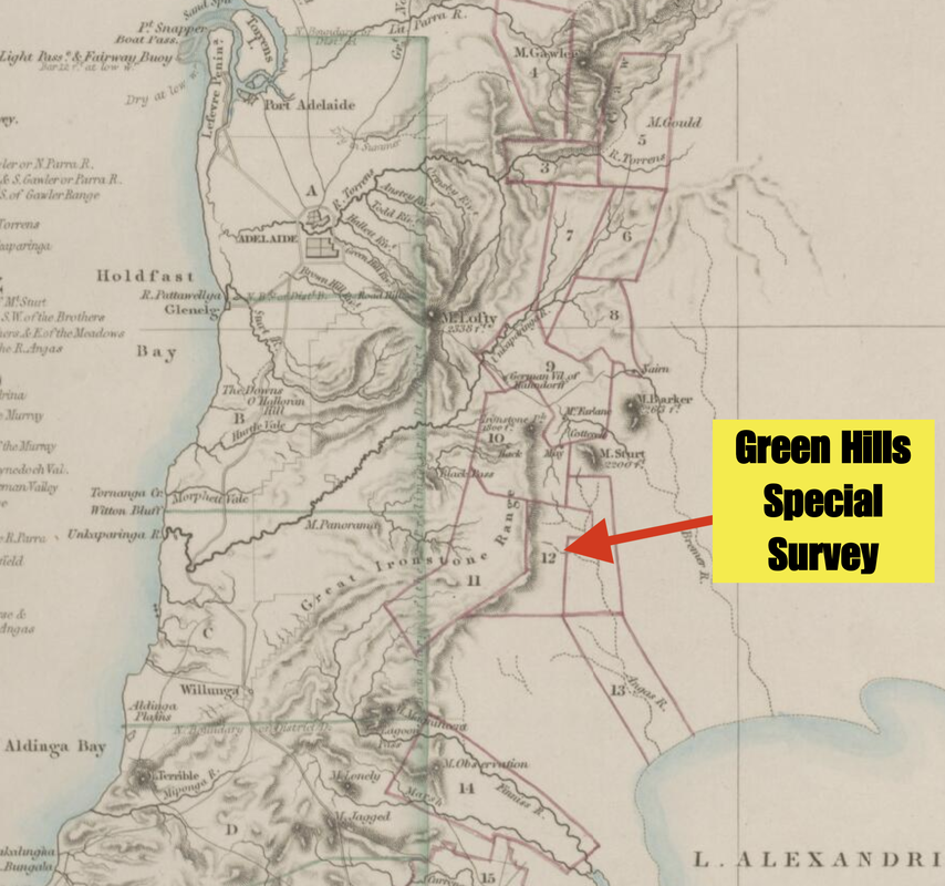
Special Surveys close to Adelaide, showing the Green Hills Special Survey.
Eventually the 'Green Hills Special Survey' developed into a river type survey which was 12 by 2 1/2 miles extending from the latitude of Mount Magnificent in the south to one mile north of Macclesfield. It included the site of Ashbourne, 13 km south of Strathalbyn.
From around 1848, farmers commenced settling in the valley, including Maylin Rogers who had emigrated to South Australia in 1838 from Dover, England. He lived in the area for about 52 years, where he died at the age of 96 years.
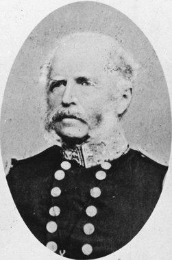
In those days the district was known as Finniss Flat, named after Captain John Finnis (1802-1872) who was associated with the famous explorer Captain Charles Sturt.
In those days the district was known as Finniss Flat, named after Captain John Finnis (1802-1872) who was associated with the famous explorer Captain Charles Sturt.
Captain John Finnis
This was followed by the Keeling and Kirkham families. Both of the families had arrived at Port Adelaide, South Australia on the same ship, the Delta, on the 31st day of October 1850, which had sailed from Plymouth on the 4th day of August 1850.
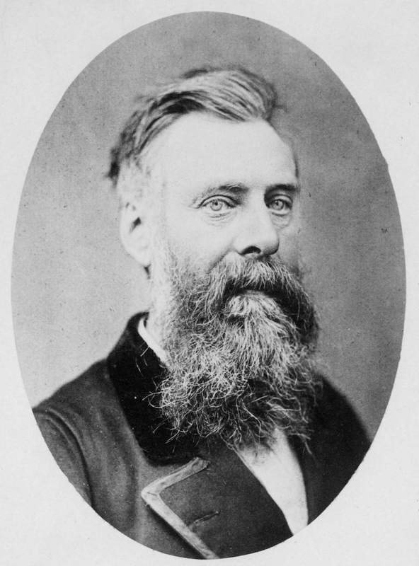
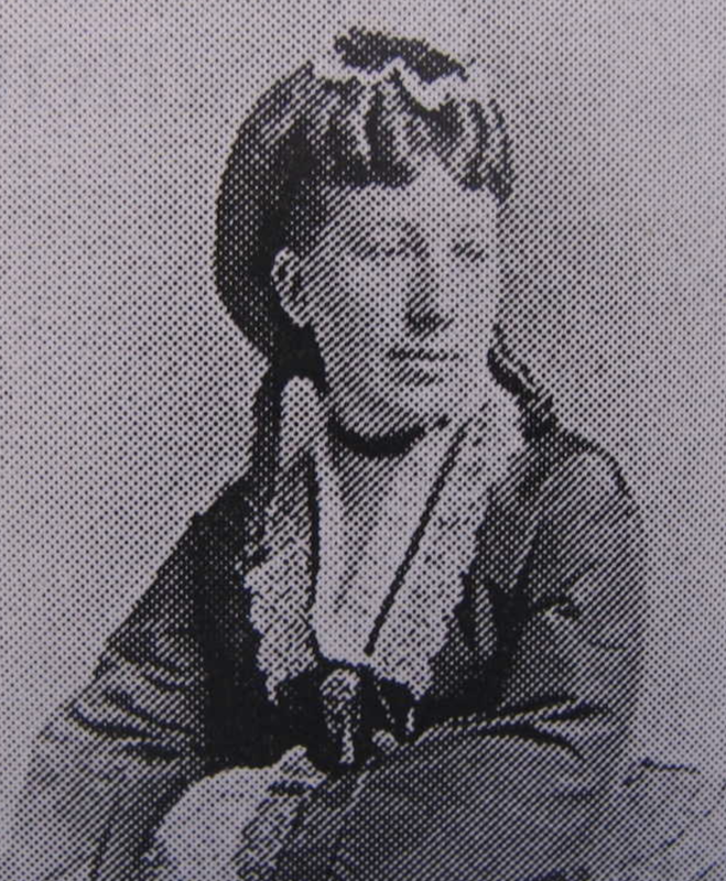
The Keeling family comprised Charles Staley Keeling, who was born on the 27th day of August 1817 in Ashbourne, Derbyshire, United Kingdom, his wife Sarah Keeling nee Kirkham (1821-1908), and their five children.
The Keeling family comprised Charles Staley Keeling, who was born on the 27th day of August 1817 in Ashbourne, Derbyshire, United Kingdom, his wife Sarah Keeling nee Kirkham (1821-1908), and their five children.
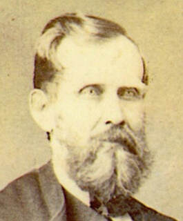
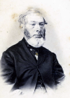
Charles Staley Keeling
|
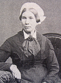
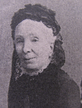
Sarah Keeling nee Kirkham
|
The Kirkham family comprised:-
Esther KIRKHAM nee ALSOP (b. 25 Dec 1792 Parwich, Ashbourne, Derbyshire, England);
Esther KIRKHAM nee ALSOP (b. 25 Dec 1792 Parwich, Ashbourne, Derbyshire, England);
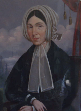
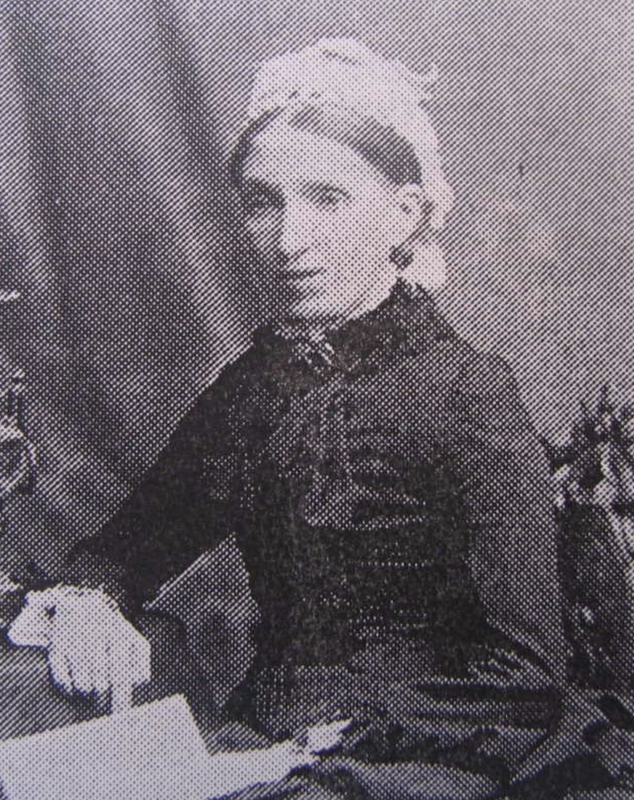
Esther Kirkham nee Alsop
and her seven children:
1. Elizabeth Kirkham (b. 16 April 1816 Parwich, Derbyshire, England);
2. John Kirkham (b. 14 Oct 1818 Ashbourne, Derbyshire, England) and his wife Sarah Cantrell Kirkham nee Potter and their three children;
3. Samuel Kirkham (b. 9 Aug 1823 Parwich, Derbyshire, England);
4. Esther Ann Kirkham (b. 27 Mar 1825 Parwich, Derbyshire, England);
5. Ellen Kirkham (b. 26 Nov 1827 Ashbourne, Derbyshire, England);
6. Christina Kirkham (b. 22 Oct 1829 Ashbourne, Derbyshire, England);
7. William Kirkham (b. 1834 Parwich, Derbyshire, England).
Sarah Keeling nee Kirkham was their sister.
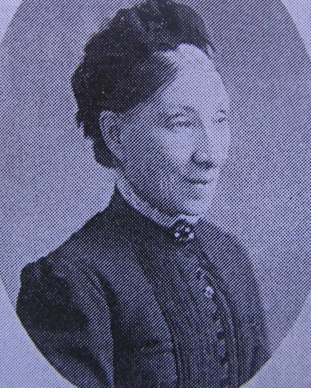
Elizabeth Kirkham
|
John Kirkham
Ellen Kirkham
|
Samuel Kirkham
Christina Kirkham
|
Other early pioneer families to follow included Maidment, Haines, Allingame, Lucas, Cox, Carter, Croston, Higgins, Gardiner, Payne, Dunn, Hogben, and Stone.
In 1853, Colonel Patrick Vans Agnew's equity in the survey was purchased from the executors of his estate by members of the Kirkham and Keeling families .
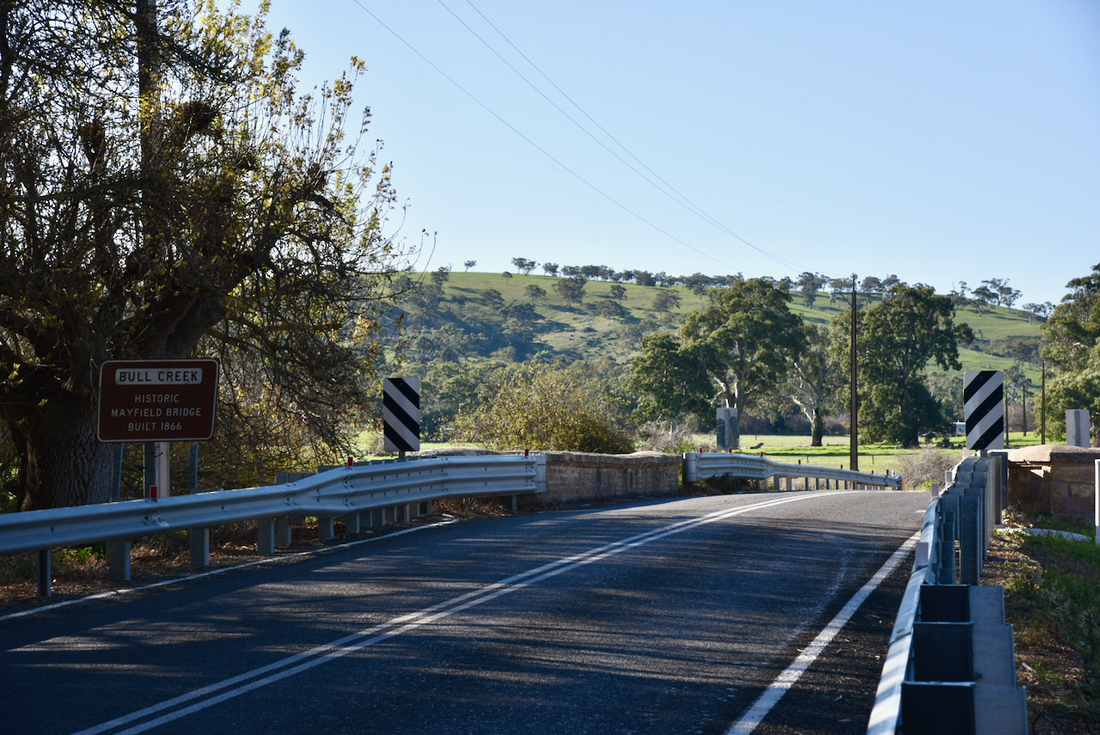
The Kirkham's property was called Mayfield and was located near the Mayfield bridge. It took its name from Mayfield, a village on the outskirts of Ashbourne in Derbyshire.
Charles Keeling built a homestead called 'Mayfield' and was named by him after a town in his native Derbyshire. It was located near the Mayfield bridge over Bull Creek. The Mayfield homestead was constructed of bluestone with brick dressings, and a number of substantial outbuildings.
'Cliff House' was the original Kirkham family home and was erected soon after the Kirkham family arrived in South Australia.
The property called 'Nowillilla' was then established. This is the aboriginal name for Finniss Flat. The house which can be found south of Ashbourne on the Goolwa Road is built into the side of a hill overlooking the river flats. The building is two-storeyed to the east and single-storeyed to the west. It is constructed on sandstone rubble. French doors opened out to the balcony and casements exist at the basement level. There is a barn adjacent to the house which is constructed of sandstone rubble with large roughly squared stone quoins.
The property called 'Nowillilla' was then established. This is the aboriginal name for Finniss Flat. The house which can be found south of Ashbourne on the Goolwa Road is built into the side of a hill overlooking the river flats. The building is two-storeyed to the east and single-storeyed to the west. It is constructed on sandstone rubble. French doors opened out to the balcony and casements exist at the basement level. There is a barn adjacent to the house which is constructed of sandstone rubble with large roughly squared stone quoins.
In 1859, on land which is now the Ashbourne cemetery, Mrs. John Kirkham laid the foundation stone of the Finniss Flat Chapel on land which was donated by her husband. Later that year the construction of the chapel was completed.
In about 1860 the Finniss Flat Wesleyan Chapel was opened. The land was given by the Kirkham family. A cemetery was located nearby, and Mr. Kirkham remained the cemetery curator for many years.
The Finniss Flat Wesleyan Chapel was no less than eight Methodist Chapels which were erected in the area between 1855-1861.
The Finniss Flat Wesleyan Chapel was no less than eight Methodist Chapels which were erected in the area between 1855-1861.
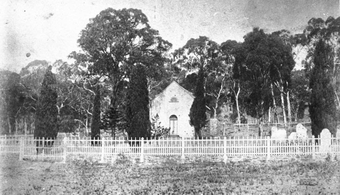
The original Finniss Flat 'Ashbourne' church, c. 1880
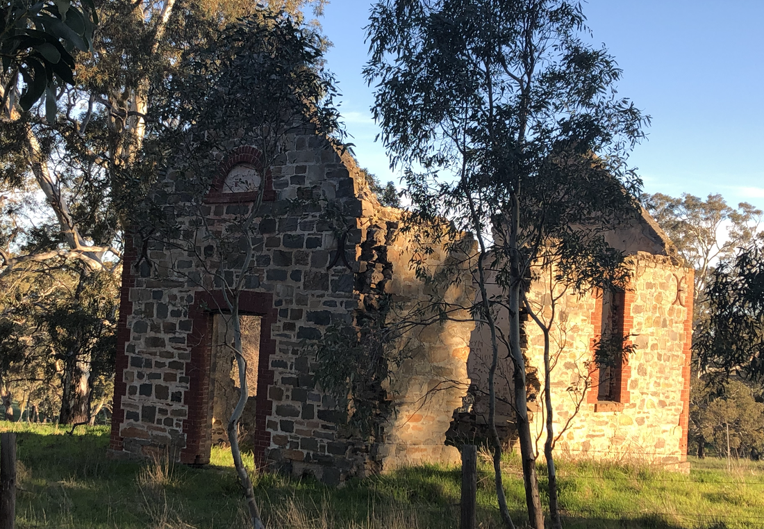
In 1861 the nearby Giles Flat Chapel was built. It was opened on the 1st day of December 1861 and was erected as a cost of about £26. Mr. William Kirkham kindly gave the necessary land.
A new chapel was opened on the site in October 1890. Ruins of the chapel can be found on Henry Martin Road.
A new chapel was opened on the site in October 1890. Ruins of the chapel can be found on Henry Martin Road.
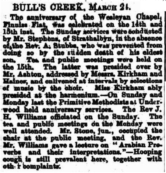
It was reported by John S. Jones of Meadows, correspondent to The Register, on the 2nd day of October 1865.......
"I see a plan furnished me that Mr. C.S. Keeling of Finniss Flat, has had a portion of his land surveyed into allotments (to form a township), varying from half an acre to three and a half acres, a great portion of it having water frontages to Bulls Creek. It is called Ashbourne, and the main lines from Adelaide to Goolwa and Strahalbyn to WIllunga run through it. It lies about midway from Meadows to Goolwa, and consequently about three-fourths of the way from Adelaide to Goolwa. There is no doubt when the main line to Goolwa (which is now in progress) is completed that it will become a flourishing township".
"I see a plan furnished me that Mr. C.S. Keeling of Finniss Flat, has had a portion of his land surveyed into allotments (to form a township), varying from half an acre to three and a half acres, a great portion of it having water frontages to Bulls Creek. It is called Ashbourne, and the main lines from Adelaide to Goolwa and Strahalbyn to WIllunga run through it. It lies about midway from Meadows to Goolwa, and consequently about three-fourths of the way from Adelaide to Goolwa. There is no doubt when the main line to Goolwa (which is now in progress) is completed that it will become a flourishing township".
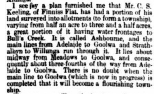
From the South Australian Register, Monday 2nd October 1865
Ashbourne was laid out in 1865 on part sections 2337 and 2339 by Charles Staley Keeling. Decimus Woodgate carried out the survey which included 42 allotments. Ashbourne was established at a relatively late date when compared with the towns of Clarendon (1840), Echunga (1849), and Macclesfield (1840).
The South Australian Gazetteer of 1866 described as Ashbourne as follows.......
'Ashbourne, postal name Finniss Flat, is a postal township lately declared in the electoral district of Mt
Barker ... and under control of the District Council of Kondoparinga. It is situated on Bull's Creek, the
Finniss Creek, and Steel's ranges lying near and to the south-west. The district is an agricultural one, wheat being the principal product. A copper mine the 'Great Bradford' lies on the Middle Finniss about 4 V. miles from the township. The nearest places are-Sandergrove 5 miles S-E; Giles Flat, 2 miles E; McHarg's Creek, 2 miles W; Meadows, 10 miles N; and Strathalbyn, 8 miles E; the communication being ... with Adelaide37 1/2 miles N-W by Rounsevell's mail coach from Strathalbyn or by an occasional carrier's dray. Ashbourne has a post office and one hotel-the Green Man. The population of the township numbers about 30 persons-that of the flat about 200, mostly small farmers.'
Originally called Finniss Flat after Lieutenant Colonel B.T. Finniss, the locality was renamed in 1869 to Ashbourne by the Kirkham and Keeling families to commemorate their native parish in Derbyshire, England.
Ashbourne derives from the Anglo-Saxon esseburne - ‘ash tree stream’
Ashbourne derives from the Anglo-Saxon esseburne - ‘ash tree stream’
In 1866, the first allotments of the town of Ashbourne were sold. Forty two allotments were surveyed including a site for a school (Lot 40). The earliest lots were purchased by James Close of Strathalbyn (Lots 9 & 11); William Gosling (Lots 21, 22, 23, 31, 37 & 39); and by the District Council of Kondoparinga (Lot 40).
The Green Man Hotel was licenced in 1866 and ceased trading three years later. From that time it has had a life as a post office and private house, and again as a hotel.
The Green Man Hotel was licenced in 1866 and ceased trading three years later. From that time it has had a life as a post office and private house, and again as a hotel.
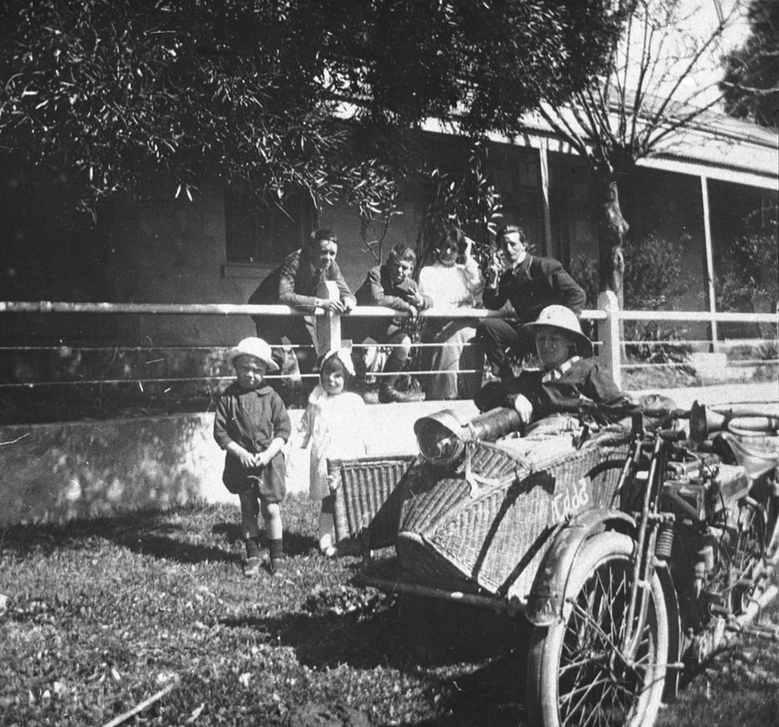
Motorcycle and sidecar, outside of the Greeman Inn, c. 1900
The original Ashbourne school was opened in 1865. It was known as the Wesleyan Sabbath School, Finniss Flat. Work commenced on the school in 1864. Below is an extract from an article in the Adelaide Observer newspaper dated Saturday the 26th day of November 1864.
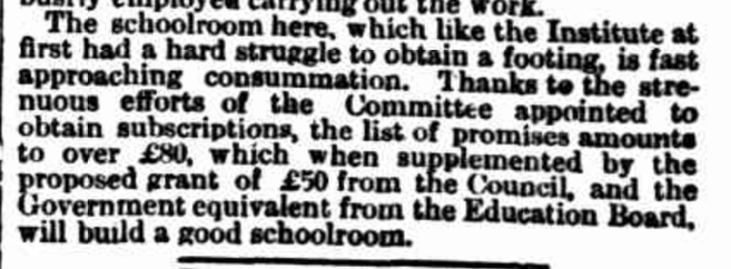
The first school teacher was Mr. Henry Ashton. The school was built of wattle and dab, with a thatched roof, and stood adjacent to where the old Finniss Flat Wesleyan Chapel once was. The Ashbourne cemetery was occupies the place where the old chapel was located. The chapel was demolished in 1890.
Mr. Ashton conducted school at Ashbourne for about 15 years until 1877. It was about this time that another school, of similar appearance, was then built in Ashbourne, opposite where the present chapel stands.
Mr. Ashton continued teaching in that building until 1878, at which time he retired and returned to England.
He was succeeded by Miss. Sarah Close until 1879. Her successor was Miss. Elsie Craddock who remained at the school until the end of 1880. Mrs. Arthur Sunman was then appointed as the teacher and she taught at the school until the summer of 1881.
It was during this time that sadly, the school was burnt down in 1881 during a bushfire.
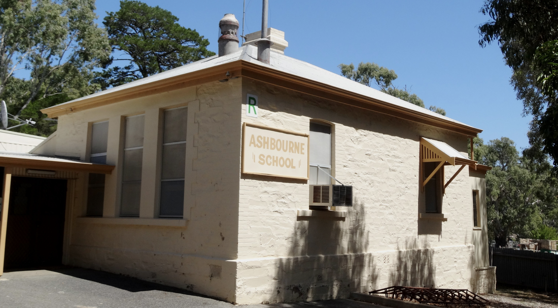
The Ashbourne State School opened in 1882, with the new building constructed of stone with an iron roof.
The school still operates as a one teacher rural school.
Mr. Ashton conducted school at Ashbourne for about 15 years until 1877. It was about this time that another school, of similar appearance, was then built in Ashbourne, opposite where the present chapel stands.
Mr. Ashton continued teaching in that building until 1878, at which time he retired and returned to England.
He was succeeded by Miss. Sarah Close until 1879. Her successor was Miss. Elsie Craddock who remained at the school until the end of 1880. Mrs. Arthur Sunman was then appointed as the teacher and she taught at the school until the summer of 1881.
It was during this time that sadly, the school was burnt down in 1881 during a bushfire.
The Ashbourne State School opened in 1882, with the new building constructed of stone with an iron roof.
The school still operates as a one teacher rural school.
During the 1850s and 1860s, Goolwa was a bustling river port. It was the last stop on the Murray River before it reached the Southern Ocean.
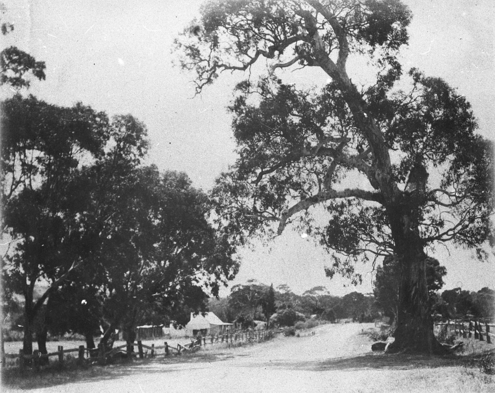
A road existed from Adelaide to Goolwa and this was known as the Bull's Creek Line. This Line after leaving Adelaide, passed through Mitcham to Kangarilla, Dashwood's Gully and the Meadows township, and then following Bull's Creek and on to Finniss Flat.
A number of rivers and creeks were needed to be crossed, including the Finniss River and Bull's Creek. This resulted in the construction of a number of bridges in the Finniss Flat (Ashbourne) area.
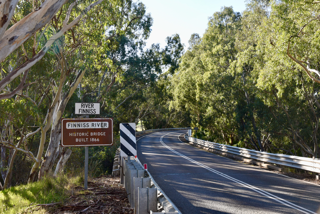
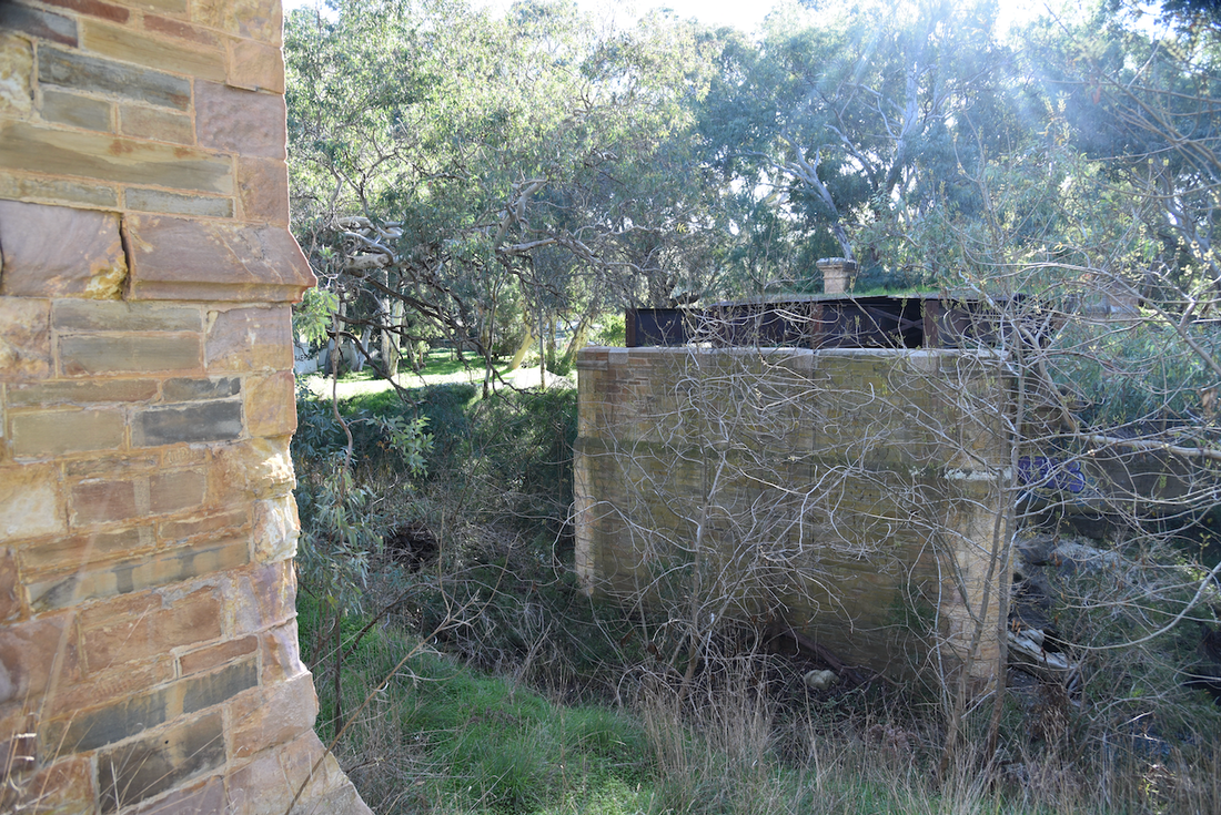
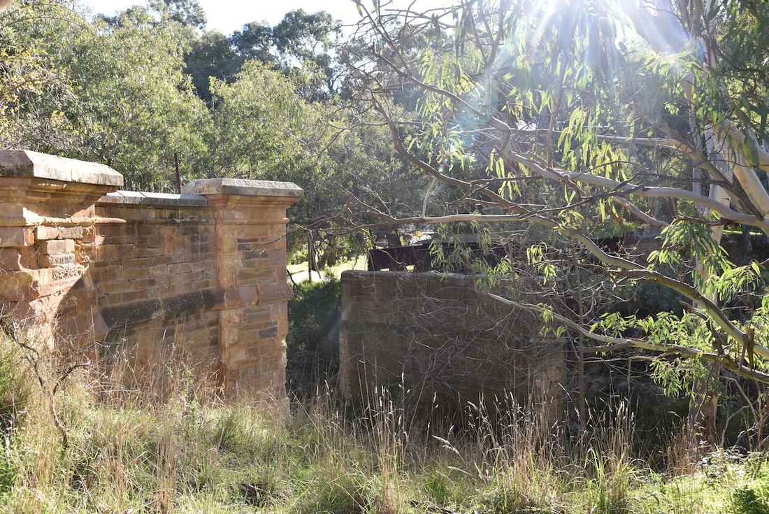
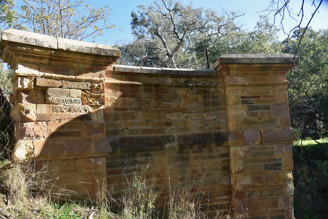
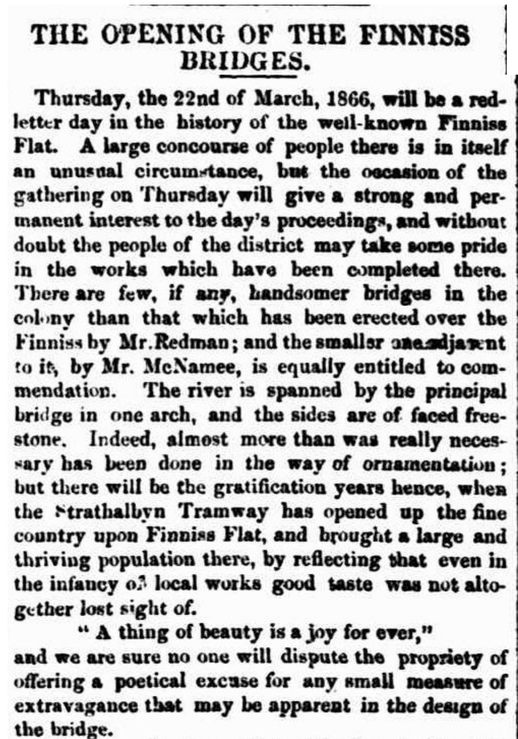
On the 22nd day of March 1866 a bridge at Ashbourne over the Finniss River. The bridge was built was Robert Redman of Port Elliot, under the supervision of Charles Townsend Hargrave, District Superintending Surveyor of the Road Board. Mr. R.D. Sorrell of North Adelaide was Clerk of the Works.. The bridge was a laminated timber arch bridge that consisted of a 75 foot span. The abutment walls were of stone with a dressing of cream coloured freestone from McHarg's Creek.
The South Argus newspaper of Port Elliot, dated Saturday the 24th day of March 1866, stated:-
"There are few, if any, handsomer bridges in the colony than that which has been erected over the Finniss by Mr. Redman".
"There are few, if any, handsomer bridges in the colony than that which has been erected over the Finniss by Mr. Redman".
|
|
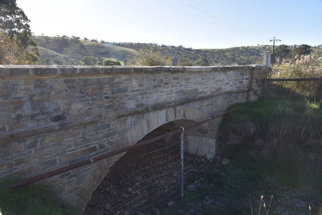
The other bridge which was opened in 1866 was the Mayfield Bridge which was constructed over Bull Creek at a cost of £641.2.0. The bridge took its name from the nearby property of the Keeling family, 'Mayfield'.
The stonework of the bridge was by William McNamee of Adelaide, under the supervision of Charles Townsend Hargrave, District Superintending Surveyor of the Road Board. Mr. R.D. Sorrell of North Adelaide was Clerk of the Works.
The bridge's official opening was described in The Register on the 24th day of March 1866.
"The bridge over Bull's Creek has the abutments of the gritstone of the neighbourhood, with dressings of freestone, and a stone arch with a twenty four feet waterway spanning the stream, the naturally flat-bedded grit made available for the purcposes of the arch, which otherwise would have had to be all of dressed stone, as are the coussoirts, or ringstones, at each end. The quoins, string-course mouldings, and caps and coping to parapets are of dressed freestone. The foundations of this bridge (the site being an alluvial flat) were difficult and expensive to out in, and are on concrete. The whole of the works ow brought to a close, including the small bridge, twelve feet span, near Finniss, involve and expenditure of about £2,700, and open this line of road (the Bull's Creek) for wheeled traffic to Goolwa".
There is a freestone plaque which contains the inscription 'Mayfield Bridge, 1866', but the plaque is badly weathered and is virtually unreadable.
|
|
The opening of these two bridges was a very big event. It was only 30 years since the colonisation of South Australia and the colony was in a period of what is now known as the 'boom and bust years'. It was the 40 year period between 1850 and 1890 when economic fortunes soared and sank in equal measure. The construction of these bridges were big, important projects.
The two bridges were officially opened on Thursday the 22nd day of March 1866, by the Governor Sir Dominick Daly. Locals lined the 'Bulls Creek Line'. The Southern Argus newspaper reported:
"Country folk in their Sunday best were moving steadily to the scene of action, or to some point on the road where His Excellency the Governor was expected to pass."
The Goolwa Cavalry troop formed a guard of honour for the Governor. The Southern Argus reported:
"when Sir Dominck Daly remembers that these fine fellows rode something like 20 miles through sand and scrub to meet him, he will surely exteem the compliment they rendered him very highly indeed."
It was reported that:
"even as far as Tapley's Hill some preparations were made to signalize the day. Incipient bunting in the shape of glowing handkerchiefs, waranted 'fats colours', flattened from convienient tree tops, and one ethusiastic rustic had strewn the Governor's path, not literally with roses, but with a quantity of green stuff, which perhaps may have conveyed a double signification."
At the Meadows, two triumphial arches had been erected with clusters of grapes interwoven, one bearing the inscription 'Welcome Sir Dominick Daly' and the other 'Welcome to the Meadows'.
Sir Dominick Daly
It had been intended that the ceremony of the opening and christening of the bridges should have taken place in the presence of the members of the Road Board and other invited guests. However, Sir Dominck Daly was in hurry, and the other guests were not waited for.
The opening was followed by a formal luncheon. The Southern Argus reported:
"The next business of the day was the inevitable feed, without which no body of Englishmen can ever complete a festivity. And on this occasion it was about the best item of the entertainments. Difficult as it must have been to transport the splendid assortment of eatables and liquors which Mr Varcoe presented to his hungering and thirsting patrons across 20 miles of sand from Goolwa, the work was accomplished bravely, and no fault could have been possibly found with the repast provided."
Those in attendance including His Excellency the Governor, the Hon. Commissioner of Public Works, the Hon. Chief Secretary, the Hon. Commissioner of Crown Lands, the Hon. W.W. Tuxford, Inspector Hamilton, Captain Higgins, Mr Jones the Chairman of the District Council of Kondoparinga, Mr. W, Everard M.P., Mr. H.E. Bright M.P., and various other guests.
Southern Argus, Port Elliot, Saturday 24th March 1866
The construction and opening of these two bridges was at a cost of about £2,700. It opened up the Bulls Creek Line for 'wheeled traffic' to Goolwa.
The bridge at Finniss Flat over Balderstone Creek was opened on 22 January 1867 by Miss Catherine Kirkham and the event was celebrated at the ‘new township of Ashbourne. The bridge is in the Italian rural style of architecture, has a stone arch parapet and wing walls and is built of the flat sandstone of the neighbourhood and has freestone dressings. The dinner was laid out in a stone building on the premises of the new public house, the Green Man, Host Gosling being the caterer.
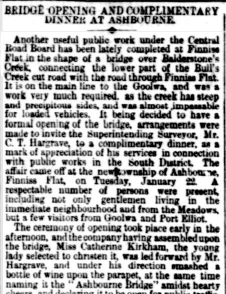
From 'The Register', Thursday 24th January 1867
By the late 1860s, the majority of the Bull Creek Road had been completed, involving at least eight bridges and fifty culverts. These bridges traversed the last major obstacles that had prevented the establishment of a permanent road link between the town of Goolwa and Adelaide.
The opening of the bridges coincided with the sale of blocks of land at Ashbourne, and this was expected to boost confidence in the Ashbourne area. However, prosperity did not come to the township of Ashbourne.
The opening of the bridges coincided with the sale of blocks of land at Ashbourne, and this was expected to boost confidence in the Ashbourne area. However, prosperity did not come to the township of Ashbourne.
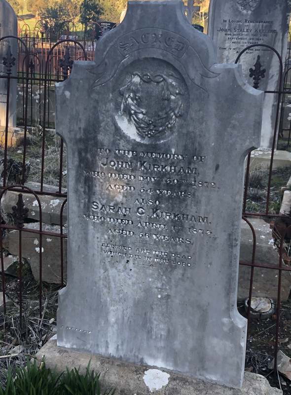
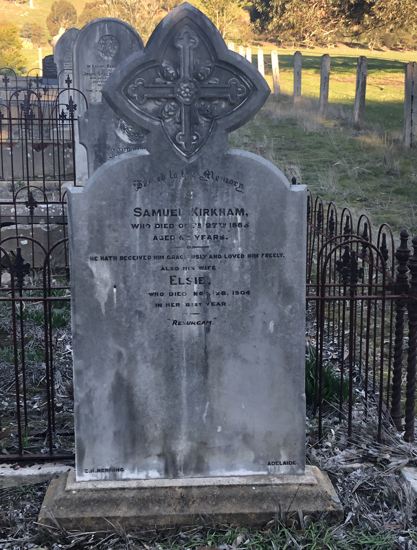
John Kirkham died in November 1872. He is buried at the Ashbourne cemetery.
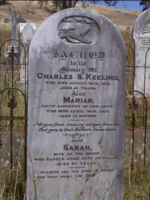
Charles Keeling died in 1875. He is buried at the Ashbourne cemetery.
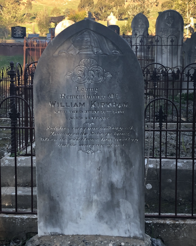
William Kirkham died in July 1877 at Ashbourne and is buried at the Ashbourne cemetery.
Samuel Kirkham died in October 1885 at Ashbourne. He is buried at the Ashbourne cemetery.
Ashbourne Main Street looking north, c. 1880
In 1891, the new Ashbourne Wesleyan chapel was constructed. It still stands today and is a Uniting Church. It is constructed of roughly squared random coursed bluestone, with stuccoed quoins and surrounds to pointed arch openings. The interior of the church is plain, with a simple matchboard ceiling, raked flooring and cedar fittings.
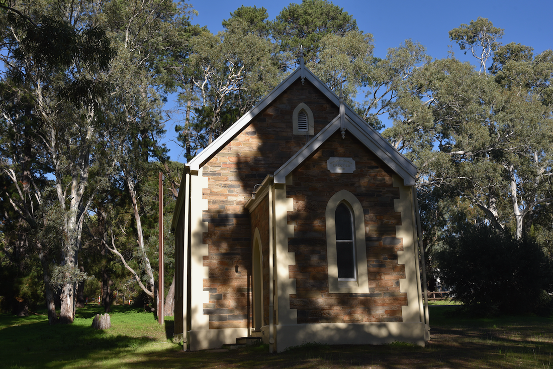
The church replaced the Finniss Flat Wesleyan Chapel which was in use between 1860-1891. The last service at Finniss Flat took place on Sunday the 14th day of June 1891, after which the church services were transferred to the new church at Ashbourne.
The earlier Finniss Flat chapel was abandoned by the settlers because access roads flooded in winer and consisted of boggy sand in summer. It is reported that the earlier chapel was moved stone by stone and reconstructed into the present church. The first service was held there on the 14th day of June 1891.
The lot on which the church is located was first purchased by W.J. Maidment in 1867. It was then sold to the Trustees of the Wesleyan Church in 1891, at which time the church was constructed. The Trustees included Nicholson, Barber, Maidment, Kirkham, C. Keeling, T. Keeling, Bradford, Howlett and Haines.
From the South Australian Chronicle and Weekly Mail, Saturday 27th March 1875.
In 1913 an Institute building was opened in Ashbourne, but this was replaced by the current besser brick hall in 1960.
Ashbourne also once had a bacon factory and a butter factory, however both closed in the early 1900s.
Ashbourne also once had a bacon factory and a butter factory, however both closed in the early 1900s.
By the early 1920s, ownership of the town of Ashbourne was effectively held by only three parties, with about 18 lots held by Mr. H.R. Meyer.
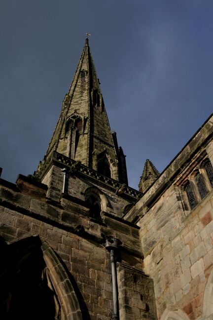
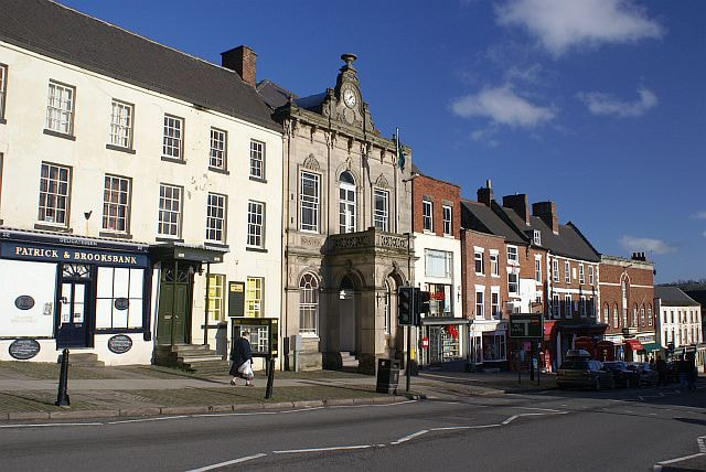
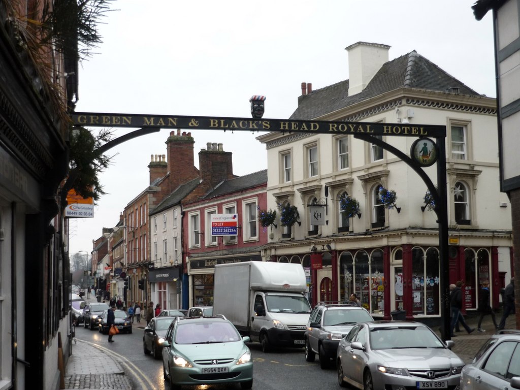
Ashbourne in the UK.
|
|
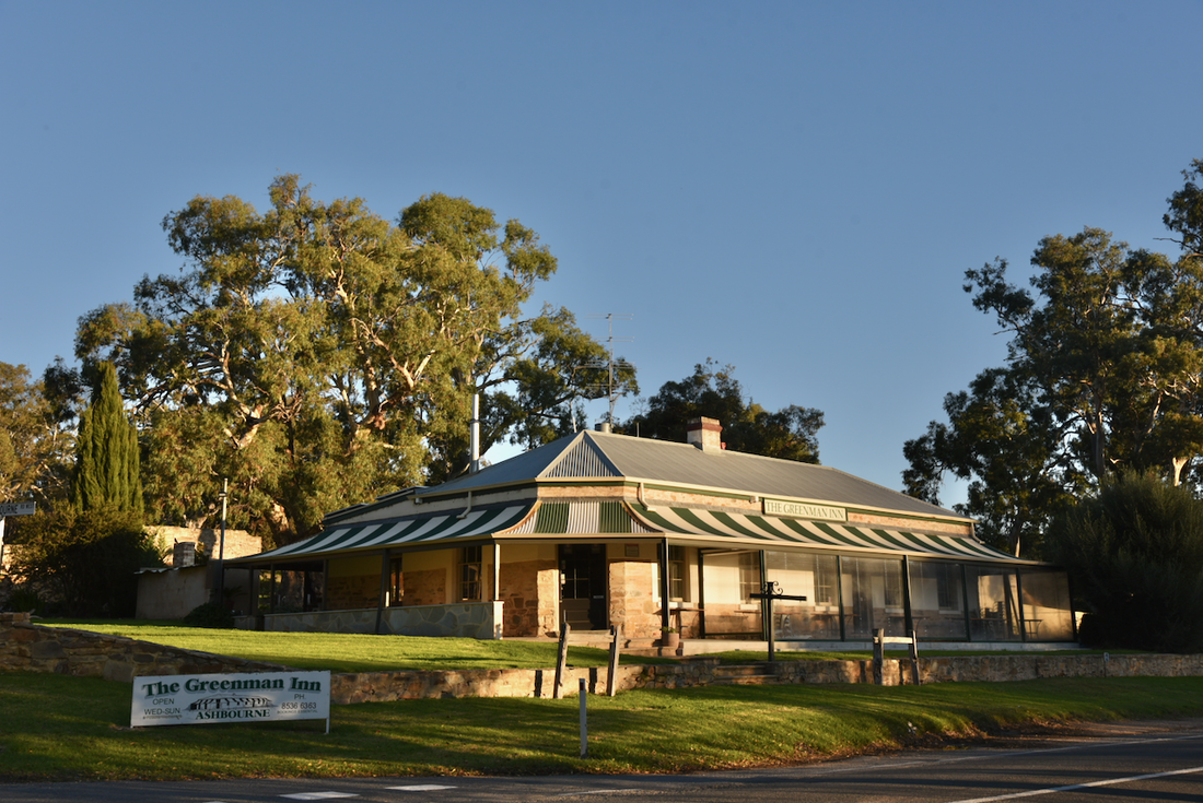
The Greenman Inn.
The Greenman Inn is located on Lot 39 and stands on the corner of the Goolwa Road and Strathalbyn Road.
It was the original Post office and General Store for the Ashbourne area. It was built in about 1866 and consists of random rubble walling, with upper section rendered. It has a splayed corner to the building's main facade.
In about 1866, William Gosling purchased the land which the hotel stands on, and it is believed that he built the hotel soon after. The Hotels Index records that the hotel was licenced by J. Thomson from 1866-1868. The building was leased from William Gosling by J. Thomson in 1867.
In 1869, Robert Haines leased the building but did not retain its licence and is recorded as opening a store in the former hotel.
For many years the buidling was run by the Maidment family as a hotel and general store. The Maidment family also built a substantial home in Ashbourne known as Kapoola, which still stands today.
More information can be found on the Greenman Inn website which can be located at.....
http://thegreenmaninn.com.au/
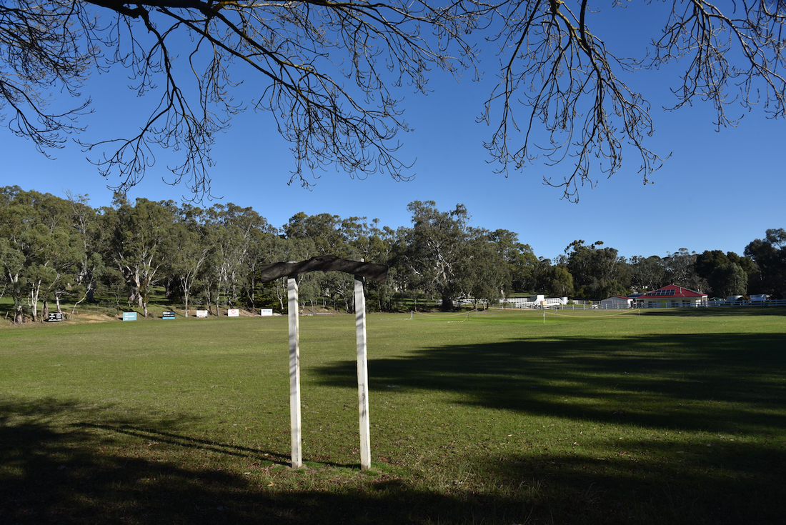
Ashbourne's famous cricket club.
Despite its small size, Ashbourne has a premier cricket club with several senior and junior grade teams. The Ashbourne Cricket Club, wearing green and gold, is known as the Bulls.
The earliest known match of the Ashbourne Cricket Club was in 1872 against Middleton and social matches were played consistently throughout the 1880s and 1890s against a range of local towns.
The Ashbourne Cricket Club has enjoyed strong links to the Adelaide Oval since that time with founding member and local identity Harry Meyers being closely affiliated with the South Australian Cricket Association (SACA). The soil which formed the Adelaide oval pitches was initially sourced from Ashbourne due to the high suitability of the black clay soils found in the area.
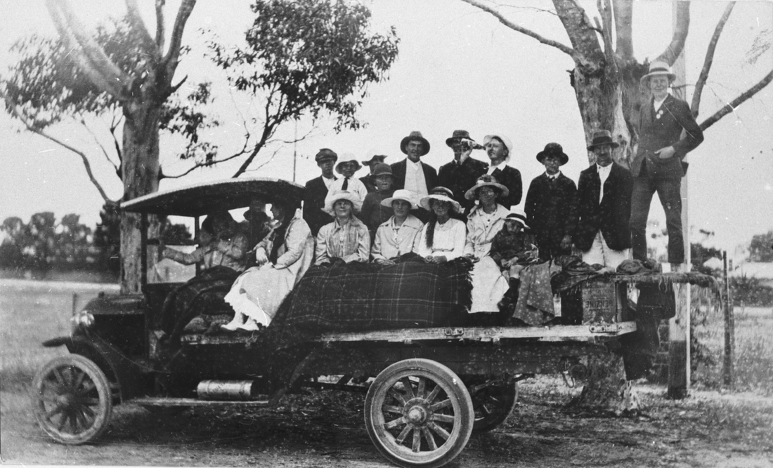
On the way to cricket, 1915.
The Ashbourne Cricket Club is the longest continuous running club in the Eastern Mount Lofty Ranges and has enjoyed a large degree of success since their formation, particularly from the 1900s to the 1950s where the club dominated the Alexandra Cricket Association. The superb grounds and turf wicket playing surfaces are regarded as being amongst the best in the Greater Adelaide Hills, Fleurieu Peninsula and Murray Lands Regions.
More information can be found on the Ashbourne Cricket Club website at........
http://ashbournecc.sa.cricket.com.au/
http://ashbournecc.sa.cricket.com.au/
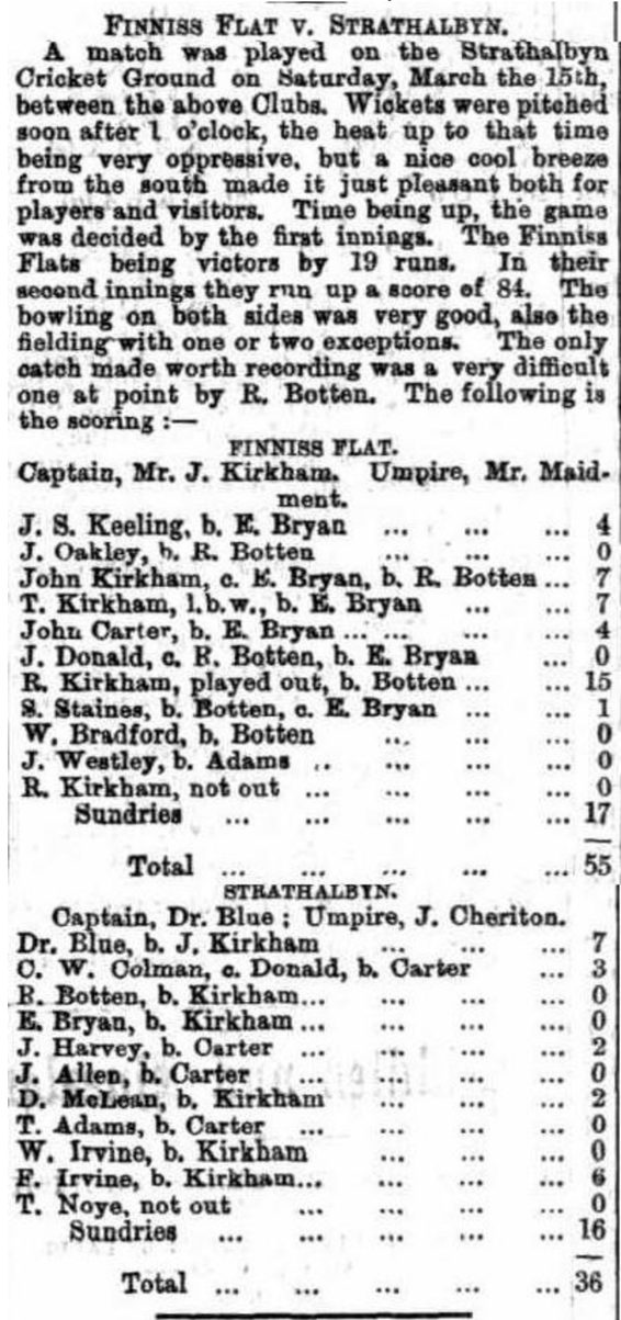
Article from the South Australian Chronicle and Weekly Mail, Saturday 22nd March 1873.
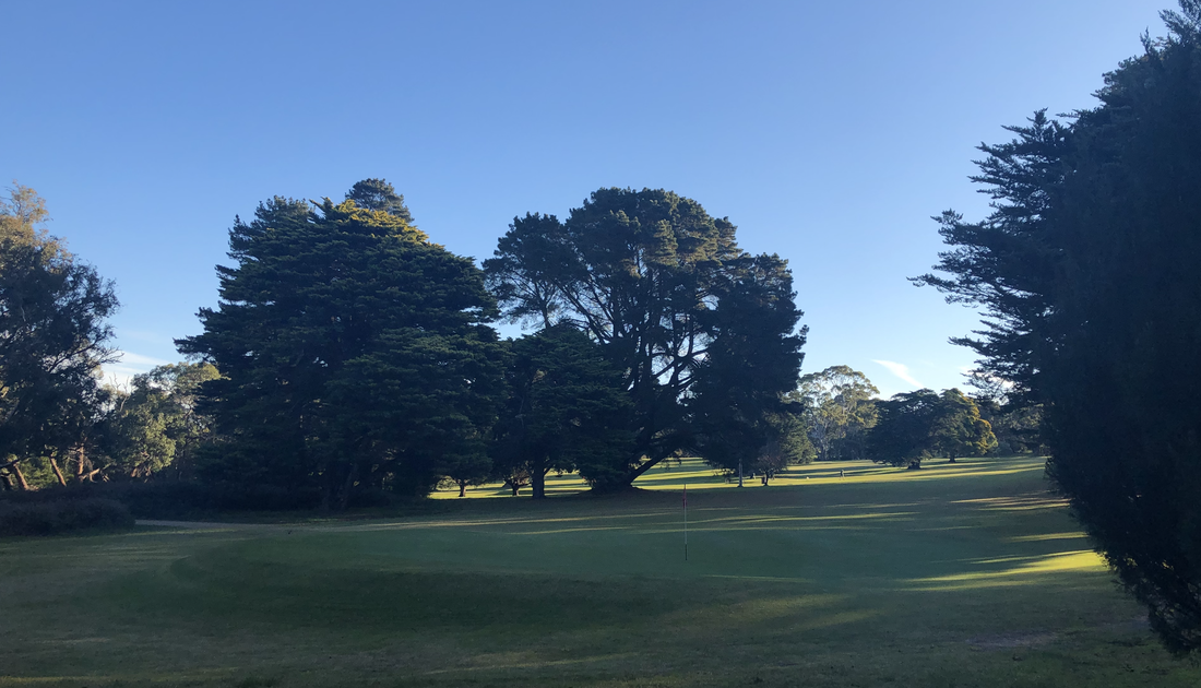
Ashbourne golf club.
This 9 hole course was established in the late 1920s.
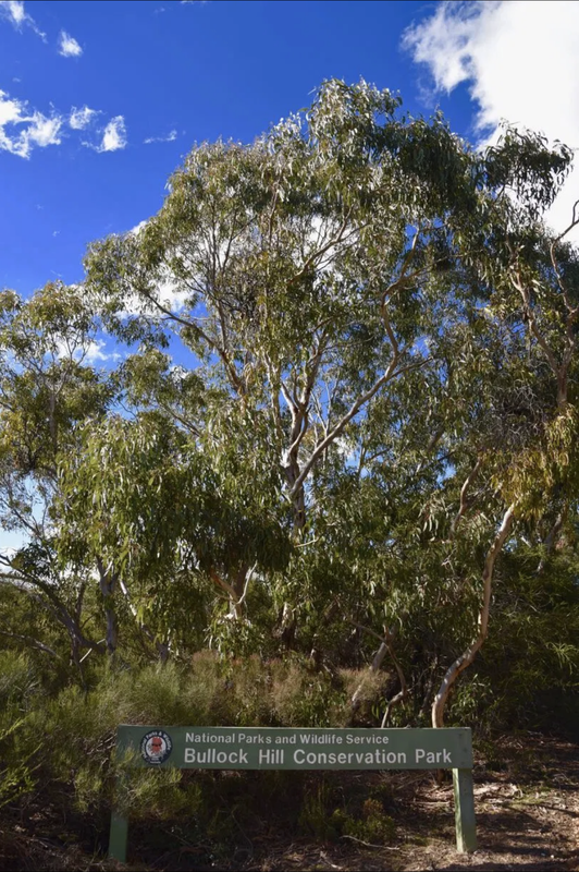
Nearby Conservation Parks.
Nearby Conservation Parks include the Bullock Hill Conservation Park, the Cox Scrub Conservation Park, the Kyeema Conservation, Park, the Finniss Conservation Park, and the Mount Magnificent Conservation Park.
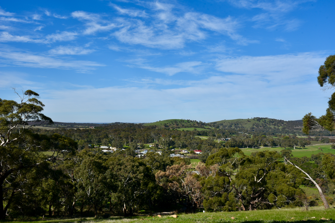
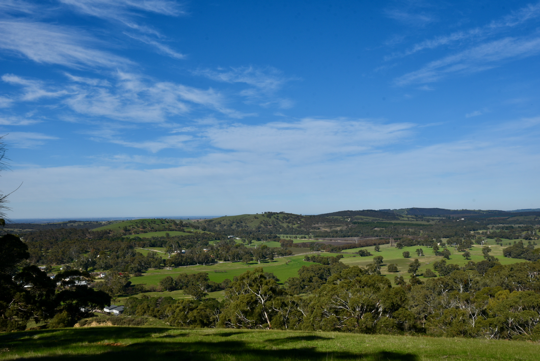
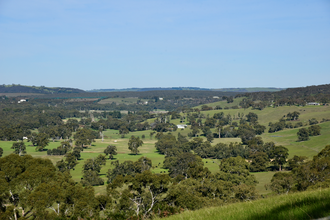
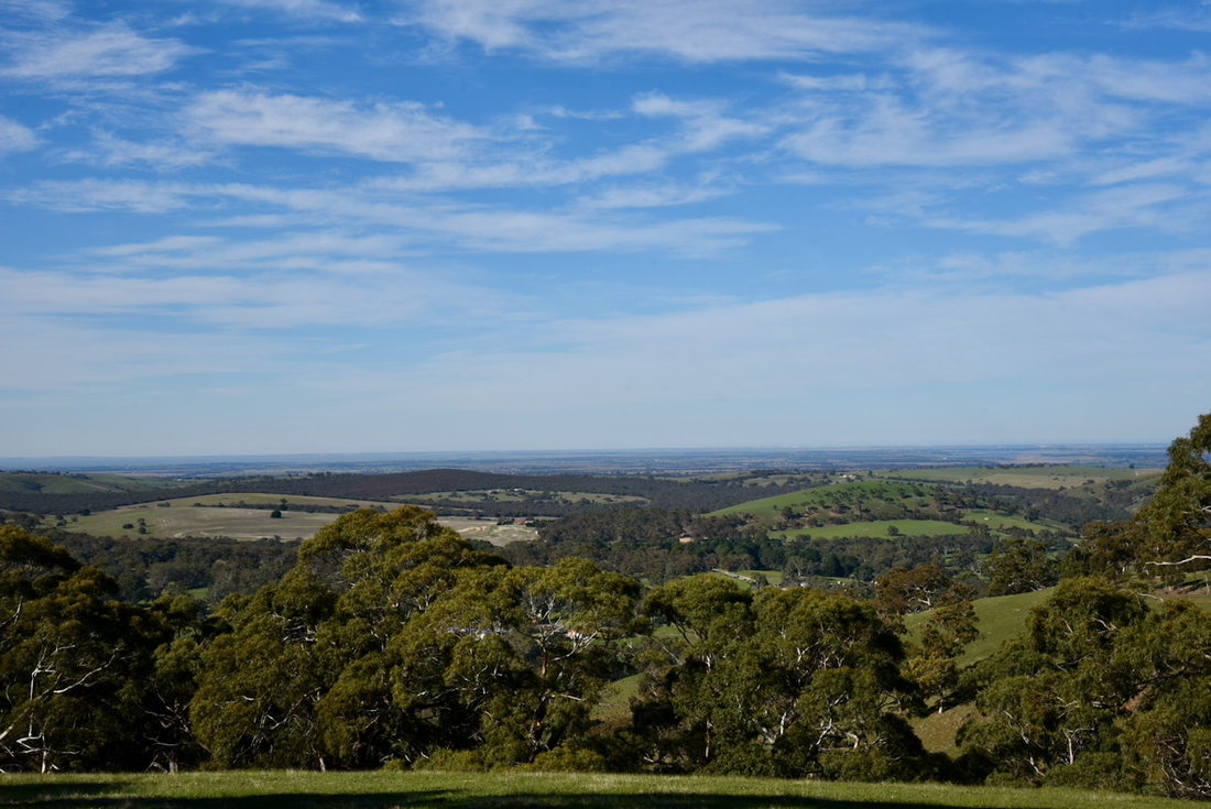
Beautiful views after leaving Strathalbyn.
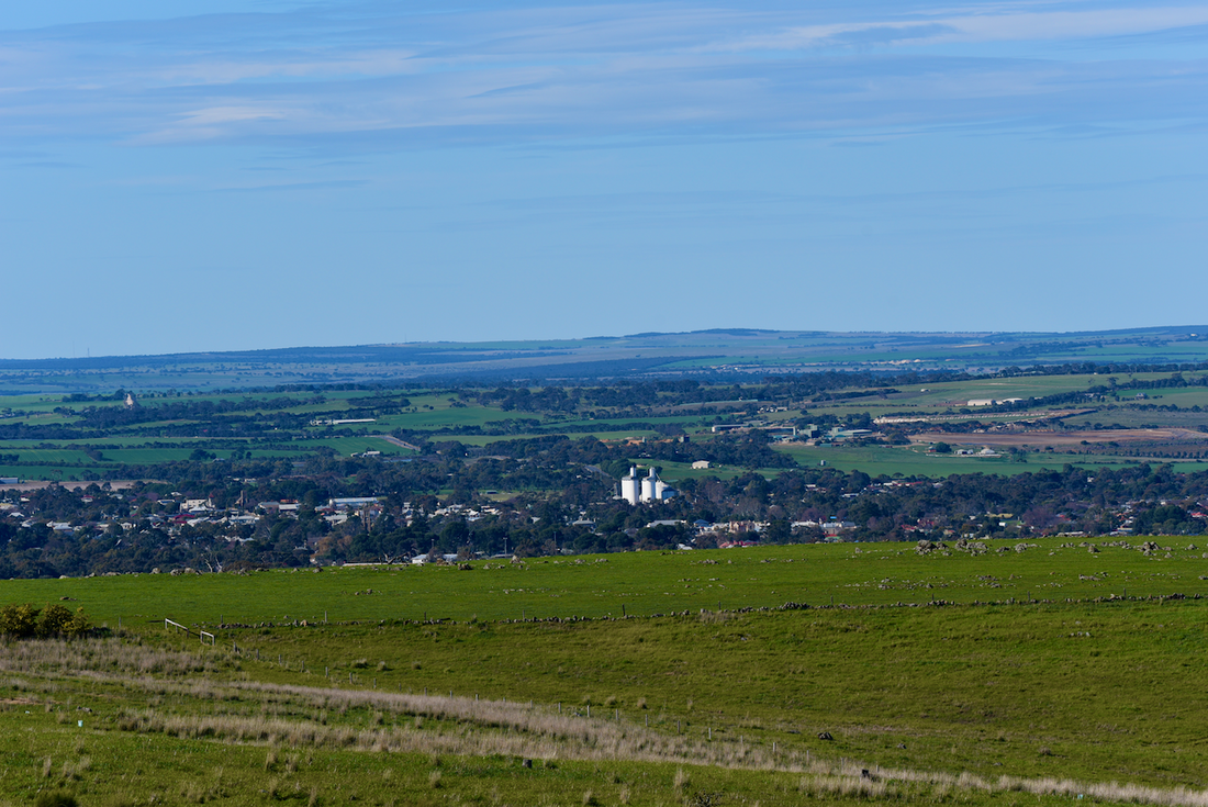
Above:- View of Strathalbyn from the Ashbourne Road.
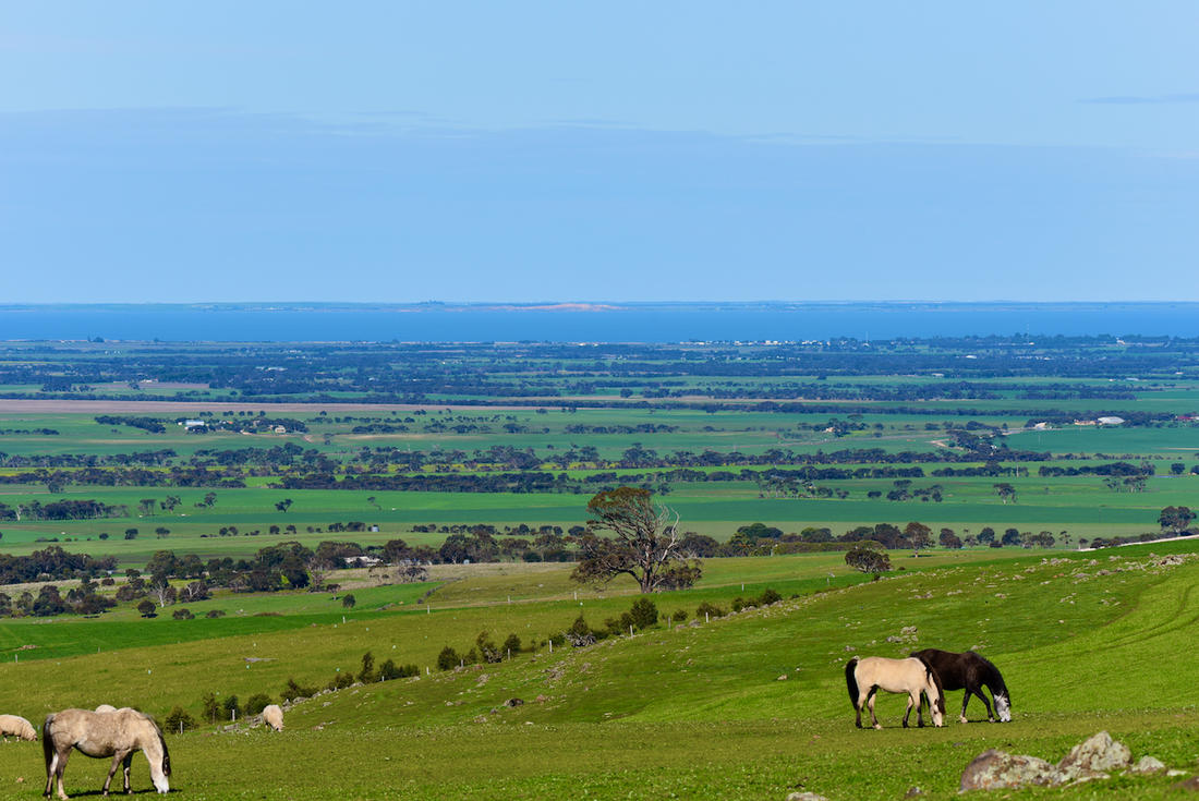
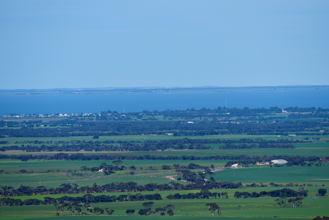
Above:- Looking south-east from the Ashbourne Road towards Lake Alexandrina and The Coorong.
Above:- Another view of Lake Alexandrina from the Ashbourne Road.
References.
1. Wikipedia, 2020, <https://en.wikipedia.org/wiki/Ashbourne,_South_Australia>
2. geni.com, 2020, <https://www.geni.com/people/Charles-Keeling/6000000061966637955>
3. Wikipedia, 2020, <https://en.wikipedia.org/wiki/Ashbourne,_Derbyshire>
4. Wikipedia, 2020, <https://en.wikipedia.org/wiki/John_Morphett>
5. Alexandrina Local History, 2020, <http://alexhistory.pbworks.com/w/page/1724522/Bull%27s%20Creek%20Road>
6. The Greenman Inn, 2020, <http://thegreenmaninn.com.au/>
7. Proformat News, 2020, <http://www.jaunay.com/newsletter/newsletter79.html>
8. State Library South Australia, 2020, <https://guides.slsa.sa.gov.au/c.php?g=410270&p=2794886>
9. Wikipedia, 2020, <https://en.wikipedia.org/wiki/Mayfield,_Staffordshire>
10. Wikipedia, 2020, <https://en.wikipedia.org/wiki/John_Finnis_(captain)>
11. Trove, 2020, <https://trove.nla.gov.au/newspaper/article/97244262?searchTerm=ashbourne%20school%201881&searchLimits=>
12. Bound for South Australia, 2020, <https://bound-for-south-australia.collections.slsa.sa.gov.au/1850Delta.htm>
13. ancestry.com, 2020, <https://www.ancestry.com.au/>
14. Wikipedia, 2020, <https://en.wikipedia.org/wiki/John_Wrathall_Bull>
15. flickr, 2020, <https://www.flickr.com/photos/31967465@N04/8248442198/>
16. Stark; P, 1983, 'Meadows Heritage'
17. State Library South Australia, 2020, <https://published.collections.slsa.sa.gov.au/placenamesofsouthaustralia/A.pdf>
18. flickr, 2020, <https://www.flickr.com/photos/82134796@N03/12894497934/in/photostream/>
19. Adelaide Now, 2020, <https://www.adelaidenow.com.au/news/south-australia/south-australia-18581890-the-boom-and-bust-years-that-shaped-our-state/news-story/c7ae1d77f11abc3e7836a30f48143ec6>
20. Wiki, 2020, <http://alexhistory.pbworks.com/w/page/1724522/Bull%27s%20Creek%20Road>
21. Ashbourne Cricket Club, 2020, <http://ashbournecc.sa.cricket.com.au/content.aspx?file=14006|42624q>