ACTIVATION ZONE.
What is the activation zone?
It is recognised that operation from the exact top of a summit may be difficult or even impossible. Accordingly, each Association has a defined Vertical Distance from the precise summit, within which a Summit operation will be considered valid.
Operation must be within 25m vertically of the summit.
The Australia - South Australia (VK5) Association defines the SOTA Activation Zone as "an unbroken area within 25 vertical metres of the summit."
If you are able to get to within 25 vertical metres of the summit, and from your oeprating position to the actual summit it is possible to get to the highest point without descending beyond 25 vertical metres, then you are within the 'Activation Zone'. If however you are on a knoll that is within 25 vertical metres of the summit, but the land drops away beyond 25 vertical metres between your operation position and the highest point at the summit, then you are not in the activation zone.
The final ascent to the activation zone shall be made only by non-motorised means.
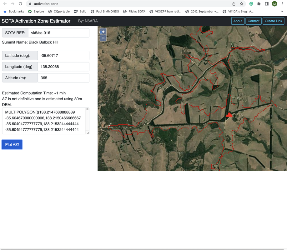
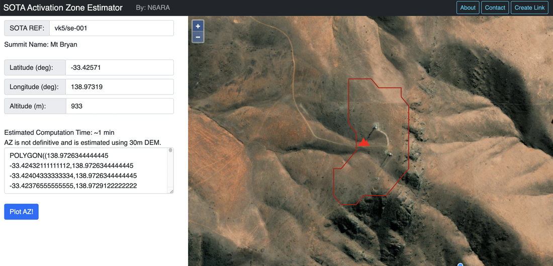
SOTA Activation Zone Estimator
The SOTA Activation Zone Generator by N6ARA generates a polygon which roughly represents the SOTA Activation Zone for a given summit. Users can either input the SOTA Reference or manually input the latitude, longitude, and altitude of the summit.
Below is an example for Black Bullock Hill VK5/ SE-016.
And this one is for Mount Bryan VK5/ SE-001.
Information courtesy of:-
- VK5 Reference Manual and Wayne, VK3WAM